Welcome
Map Based Investigations
Provide students with the opportunity to acquire information from an interactive map. As students explore the maps they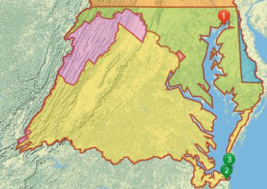 employ analytical skills as they interpret the information presented and draw conclusions.
Physical and Human Characteristics of the Chesapeake Bay Region
In this exercises identify the states that comprise the Chesapeake
Bay region to discover that all states in this watershed do not directly touch the Bay. They use aerial imagery to identify similarities and differences at three locations and then compare their interpretations with data from a vintage USA Topographic map. They are challenged to compare land use patterns at the state and county scales to determine how scale affects data interpretation.
Exploring Virginia Watersheds
 Where does Virginia’s water go? This map-based investigation answers that question by tracing the pathways the Roanoake, James, and New rivers take to the sea Students examine the components of a river system and investigate changes in salinity throughout the Bay. As students interact with the map, they pose questions and craft hypotheses to predict relationships among elevation, topography, and fresh water.
- Exploring Virginia Rivers (pdf)
- Exploring Virginia Rivers (Word, without answers)
- Link to Map
Chesapeake_Bay_Lesson from the Instrudctional Guide to ArcGIS, second edition by Keranen and Malone.