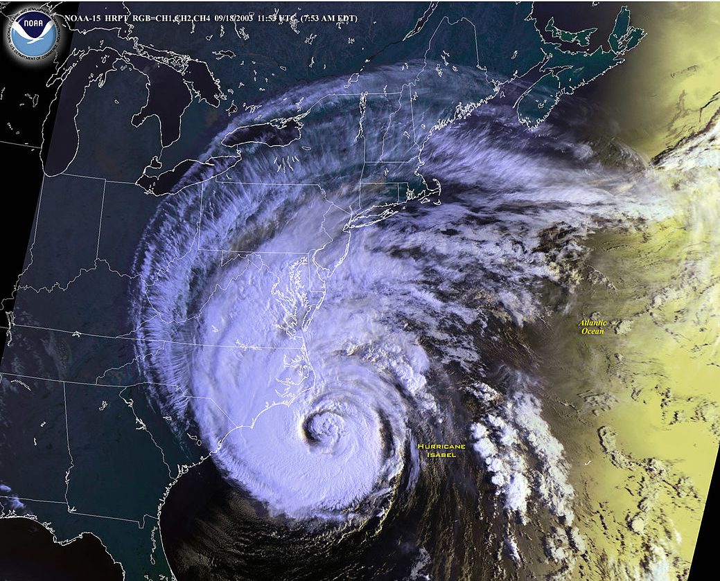
On September 18, 2003, Hurricane Isabel entered Virginia, beginning what would become the costliest disaster in the history of the Commonwealth [1]. Though Isabel was weakened from a category 5 hurricane at sea to a category 1 by the time it entered Virginia, strong winds affected 99 counties and cities in the state, and 1.8 million people were left without power. Storm surges from Isabel peaked at around 9 feet in Richmond at the James River, and places such as Sherando, Virginia experienced 20.2 inches of rainfall. The National Weather Service attributes 10 deaths directly to the storm, and another 26 as indirectly related. Damage to the state of Virginia totaled $1.85 million [2].
The coast of Virginia experienced wind gusts from 50 mph to 70 mph, while storm surges reached unofficial estimates of almost 11 feet and heavy waves resulted in beach erosion and overwash [3][4][5]. The historic Harrison’s Pier in the Ocean View area of Norfolk was completely destroyed, and the 15th Street fishing pier in Virginia Beach was significantly damaged [6]. Northern Virginia experienced storm damage as well; in Fairfax County, the storm surge washed out 160 homes and 60 condominiums, with 2000 units reporting flood damage [7]. Flooding and downed trees destroyed two houses and damaged 192 homes in Arlington County [8].
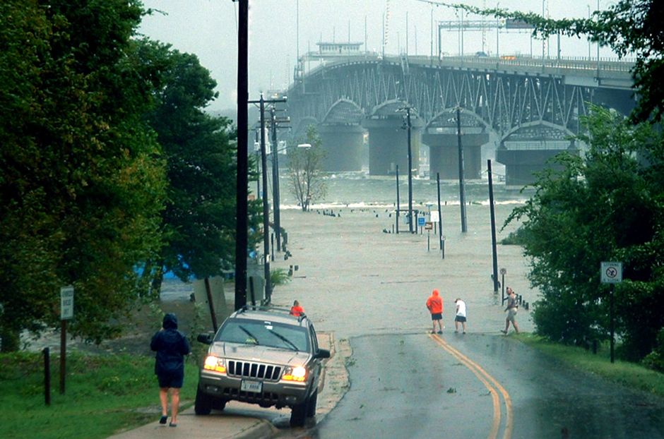
However, the storm had effects on much more of Virginia than the coast. Storm surges along the James River wreaked havoc on homes in Claremont, Burwells Bay, and Henrico County, where a resident drowned after crashing into a flooded creek [9]. A motorist on Interstate 95 in Richmond died when he hydroplaned and crashed his car [10]. Monetary damage in the central region totaled about $3 million [11]. Intense rainfall in Augusta County, combined with wind gusts of around 60 mph, resulted in downed trees and power lines [12]. Rainfall led to both river flooding and flash flooding; four emergency spillways to dams flooded [13]. Water flowing down the Black Creek washed out the bridge, along with other sections of asphalt along State Route 608, and the South River at Waynesboro destroyed four bridges [14]. Emergency management personnel evacuated about 300 people from rapid flooding, 21 by boat [15]. The photo to the left, taken September 18, 2003, courtesy of The Virginia Institute of Marine Sciences, shows storm-surge flooding from Hurricane Isabel at Gloucester Point on the York River.
Though there was some warning before Hurricane Isabel struck Virginia, it is impossible to predict the exact path, strength, and nature of natural hazards. Coastal homeowners often think they are adequately prepared, and inland homeowners assume that hurricanes will have little or no effect on their property. However, natural hazards are volatile and unpredictable. With the information provided in this manual, homeowners can equip themselves to face natural disasters confidently with knowledge and preparation.