Participatory Mapping
Participatory mapping is a key component of ASERT.
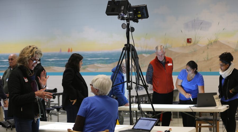
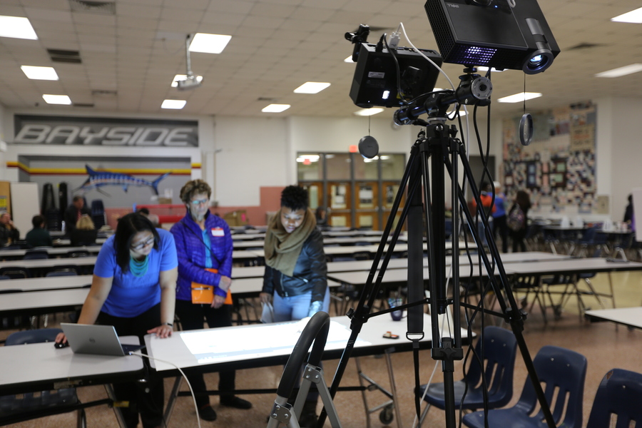
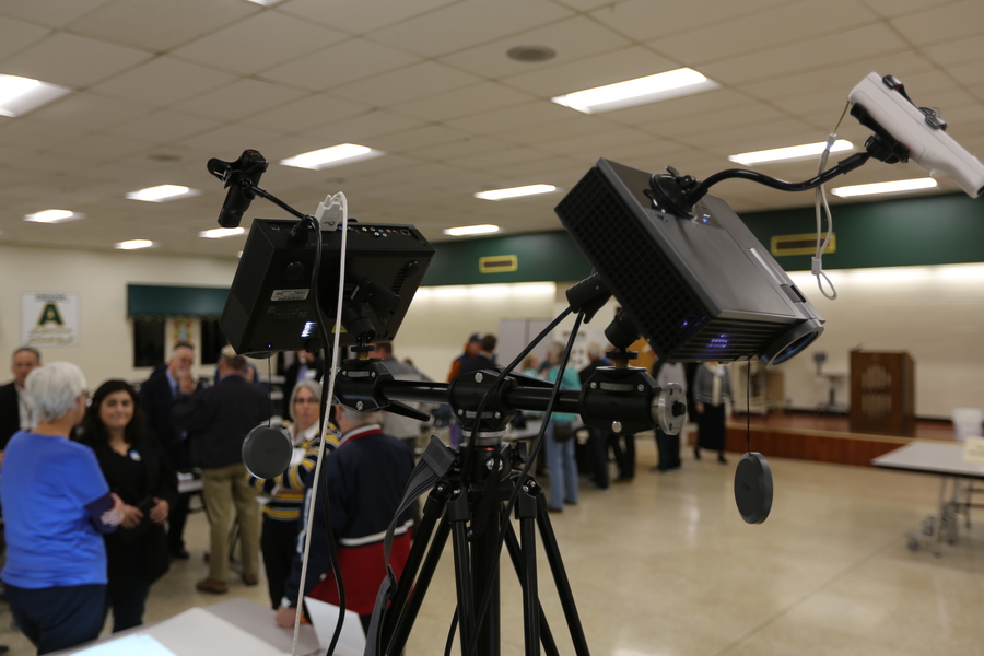
For live engagement events we use the weTable for visualization of the impacts of SLR and identification of community assets and challenges.
- The weTable was originally developed by the Texas Sea Grant but is used throughout the country such as by the Delaware Sea Grant and New Hampshire Sea Grant.
- The weTable is platform to present maps and geospatial data representing elements of the hazards associated with coastal inundation resulting from SLR and/or storm surge.
- The data highlights the impact of these hazards, such as on critical infrastructure and personal safety, and are used as a starting point for identifying vulnerabilities to SLR and flooding.
- The weTable uses Wii technology to create an interactive tabletop that allows participants to simultaneously visualize SLR scenarios while collaboratively exploring and identifying vulnerabilities. It works by projecting a computer screen onto a tabletop surface. Participants interact with information using a light pen connected to the laptop via Wii remote.
We also use an online community map (an ESRI story map) to engage online participants.
- Access the community resilience web map here.
- Residents of Hampton Roads can use this web mapping app to identify and map (1) assets that exist in their community that they particularly value, and (2) challenges their community faces with respect to increasing flooding.
More information
- Presentation about ASERT at the Hampton Roads Adaptation Forum (February 24, 2017) .
- Participatory GIS as a tool for stakeholder engagement in building resilience to sea level rise: A demonstration project (read article here).