Measure the Muck Website: https://arcg.is/1G4i1y1
Catch the King Interest Survey: https://forms.gle/8fTqwEL6BuPxYZey6
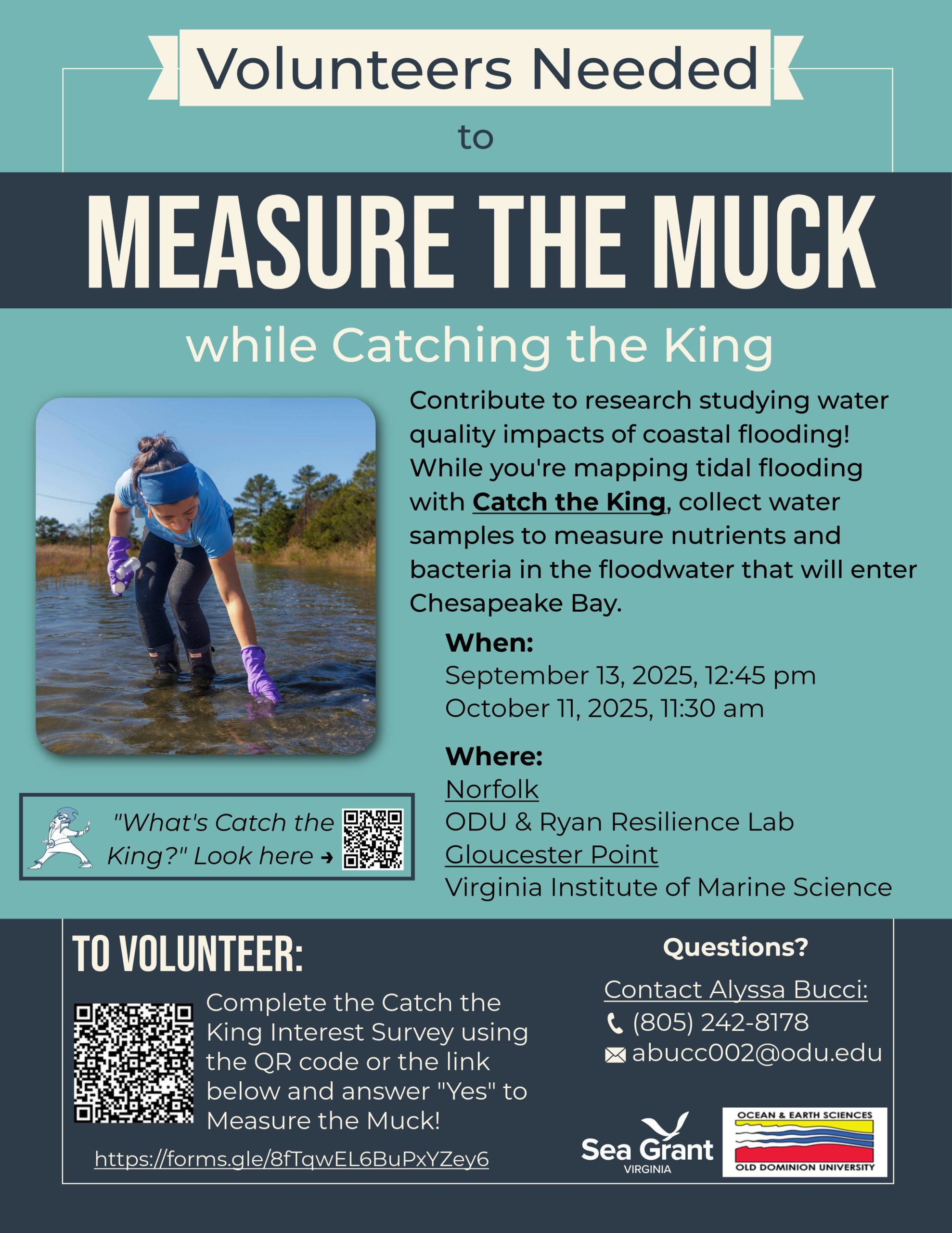
The lower Chesapeake Bay has been impacted by anthropogenic activities for centuries, and human exploitation of the landscape has resulted in severe impairments to the estuary that have elicited regulatory and community-based behavioral responses. Despite decades of restoration efforts, the Chesapeake Bay remains impaired and the Elizabeth River estuary in southeastern Virginia is one of the three most impacted urban watersheds in the Chesapeake Bay. It is highly urbanized and suffers from water quality impairments due to harmful algal blooms, low oxygen levels, and fecal contamination. Compounding these is the sharp increase in frequency of coastal flooding and inundation due to sea level rise. Southeastern Virginia is the second most vulnerable to floods and storm surges in the nation due to a combination of anthropogenic sea level rise, local subsidence, and natural climate variability. While efforts have focused on protection of infrastructure and assets at risk from flooding on land, there has been little research aimed at understanding the impacts of recurrent coastal flooding on water quality. Coastal flooding introduces both nutrients and microbes into aquatic ecosystems that can detrimentally affect water quality and humans who have contact with the water. However, nutrient and contaminant loading from coastal flooding are not currently included in water quality models advising the Chesapeake Bay Program’s restoration efforts. This project engages citizen scientists to collect water quality samples to begin to estimate nutrient loading to a Chesapeake Bay sub-tributary from coastal flooding and its variability due to land use, seasonality, and the occurrence of rainfall. In 2024, this project has been expanded to include not only the Lafayette River watershed but the Elizabeth River and York River watersheds also.
Five Years Measuring the Muck: Evaluating Interannual Variability of Nutrient Loads From Tidal Flooding. https://doi.org/10.1007/s12237-023-01245-3
Effects of tidal flooding on estuarine biogeochemistry: Quantifying flood-driven nitrogen inputs in an urban, lower Chesapeake Bay sub-tributary https://doi.org/10.1016/j.watres.2021.117329
https://www.odu.edu/oes/news/2018/12/measure_the_muck_wit
https://www.pilotonline.com/news/environment/article_39835cd2-d798-11e8-87a8-9be3908f9d79.html
https://www.dailypress.com/news/dp-nw-catch-the-king-20191025-lprxu6jx4rahbiqejvwnmzpgjy-story.html


